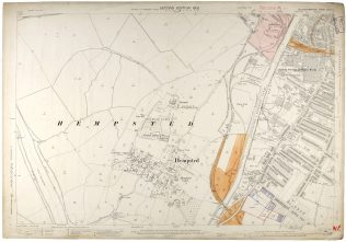
Fielding and Platt Sports Ground
Shown in 1902 Ordnance Survey Map of Hempsted

Ordnance Survey Map of Hempsted (1902) held at Gloucestershire Archives (reference D2428/3/33/2)
Click on the photograph to enlarge the image.
Ordnance Survey Map of Hempsted (1902) at Gloucestershire Archives (reference D2428/3/33/2)
What memories of Fielding’s sports’ ground and the surrounding area of Hempsted does this map bring back for you?


No Comments
Add a comment about this page