

Click on the maps to enlarge the images and zoom in.
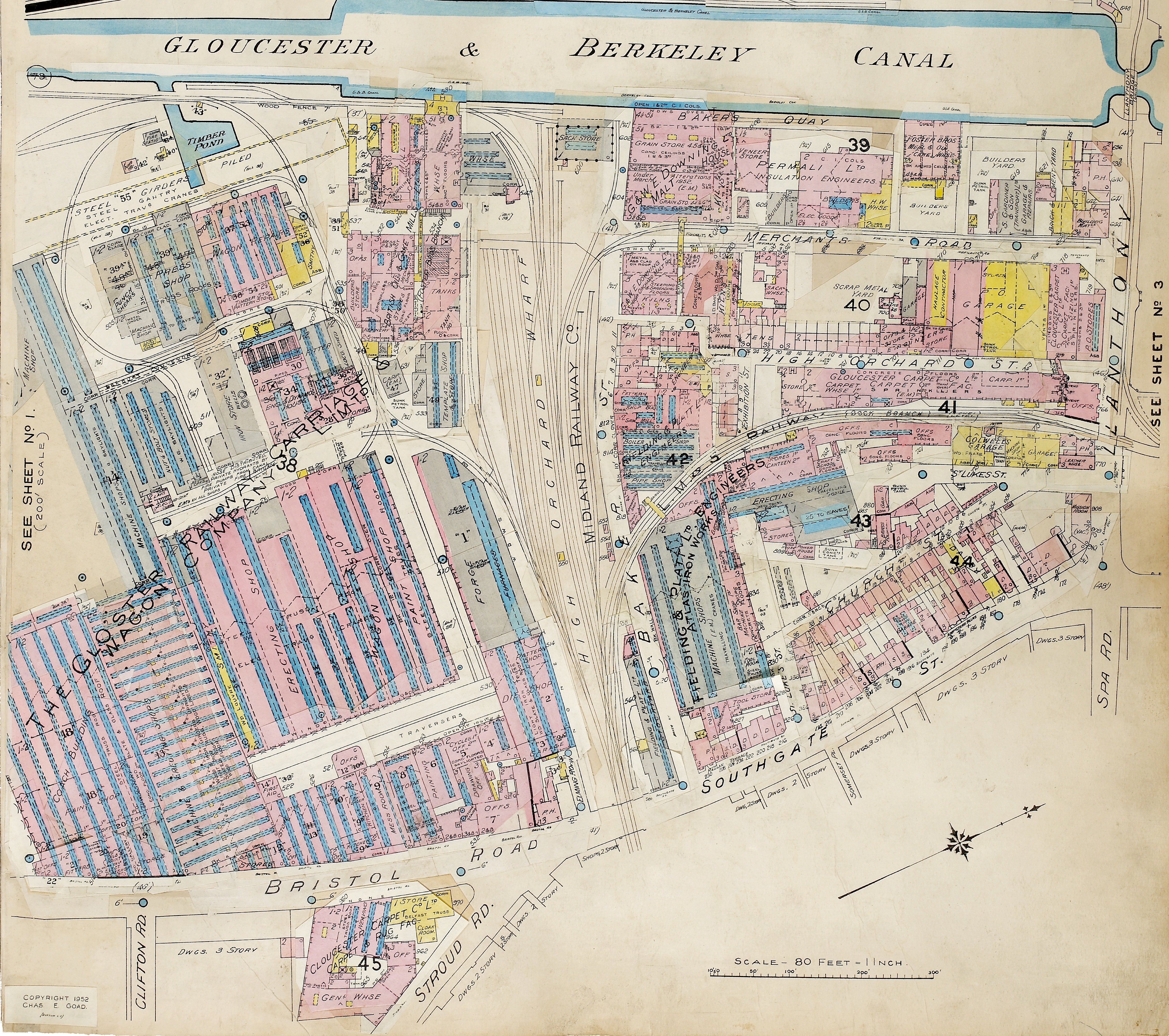
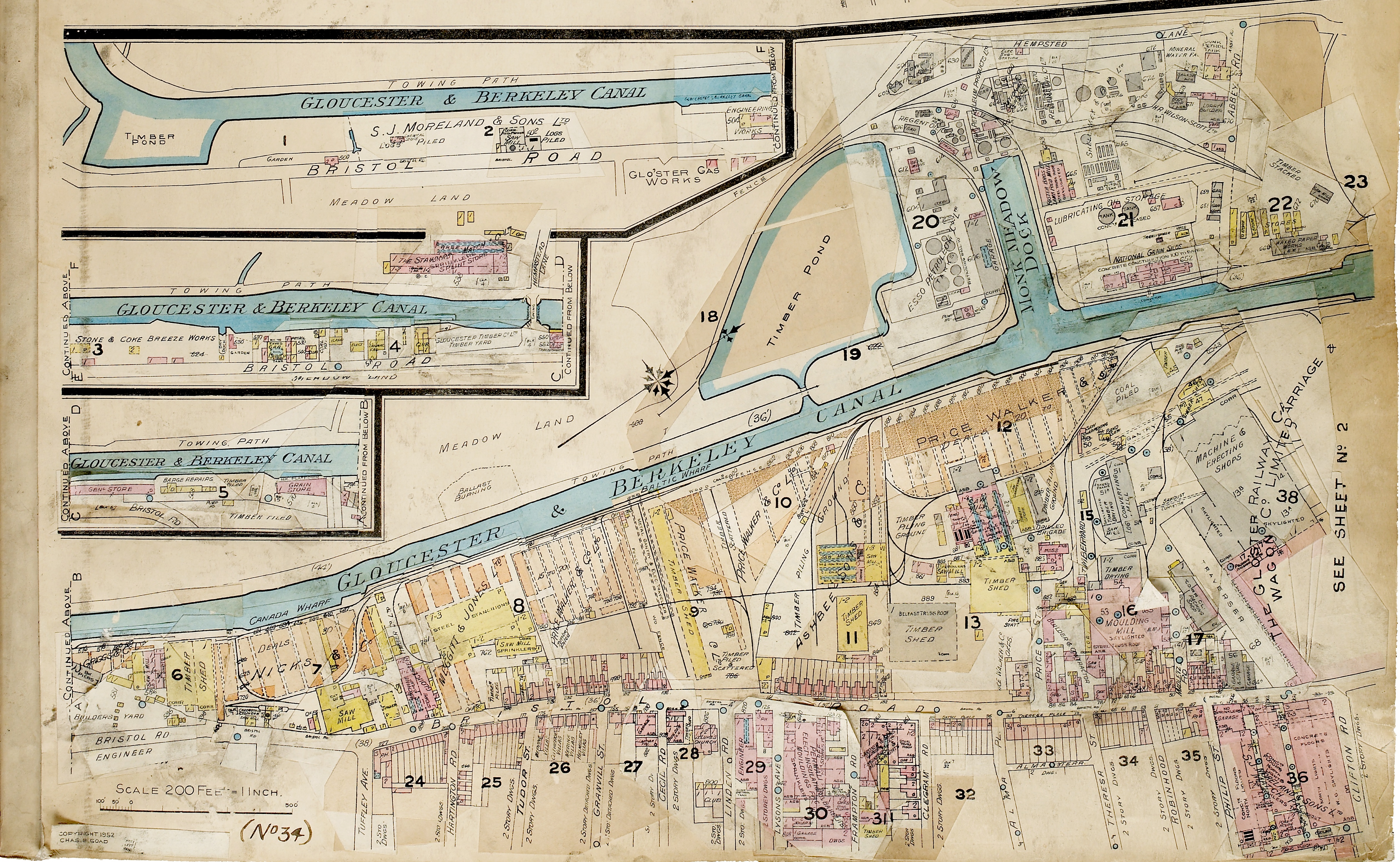
These maps show the Fielding and Platt Works and The Bristol Road in 1952. They show just what an industrial area The Docks and The Bristol Road was.
If you remember the Fielding and Platt Works or any of the locations on the maps please share them with us by leaving a comment at the bottom of this page. Perhaps you used to travel through the area to work? Or maybe you lived, worked, or went to the pub in the areas featured on the maps? If so, we’d love to hear from you and to know what the shops, pubs, houses, and atmosphere of the streets was like.


No Comments
Add a comment about this page